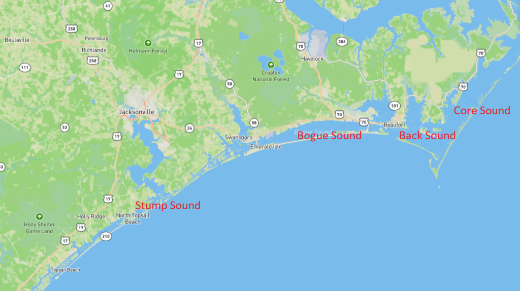
Coastal Carolina Riverwatch provides service to the following Sounds:
- Back Sound
- Bogue Sound
- Core Sound
- Stump Sound
Did you know?
British explorers described inlets containing islands as sounds, and bodies of water not fully open to the ocean. There is one theory that stems from the exploration days, that when a sailor or sailors come home on their large vessels after stormy, treacherous voyages, it was good to be safe and “sound”.

Core Sound is located between the mainland of Carteret County and Core Banks, part of the Outer Banks of North Carolina. It lies between the Pamlico Sound to the northeast and the smaller Back Sound to the west. Several inlets connect the sound to the Atlantic Ocean. Communities on the mainland side of the sound include Marshallberg, Davis, Sea Level, and Atlantic. There are no permanent settlements on Core Banks.
Back Sound is a small saltwater sound connecting Core and Bogue Sounds. It is 8.5 miles long and up to 2 miles wide. It is shallow and calm and is protected from wind and currents by the Shackleford Banks to the south.
Bogue Sound is a body of water running along the crystal coast from the Back Sound to the western Bogue inlet. It is 25 miles long and up to 3 miles wide. It contains shallow and calm water with slow-moving currents. It is bordered by the barrier islands to the south and the North Carolina mainland to the north. Its close proximity to many major North Carolina beaches makes it very popular with vacationers.
Stump Sound is the southern tip of CCRW’s jurisdiction and contain the bodies of water behind Topsail Island. The area includes a series of bays and islands that surround the Intracoastal Waterway. The sound is 26 miles long and can range in depth from inches to feet depending on dredging.
Parts of Core Sound, Black Sound, western Bogue Sound, and Stump Sound are classified as “Outstanding Resource Waters” which are a subset of “High Quality Waters” by the US Environmental Protection Agency. This supplemental classification is intended to protect unique and special waters having excellent water quality and being of exceptional state or national ecological or recreational significance.
