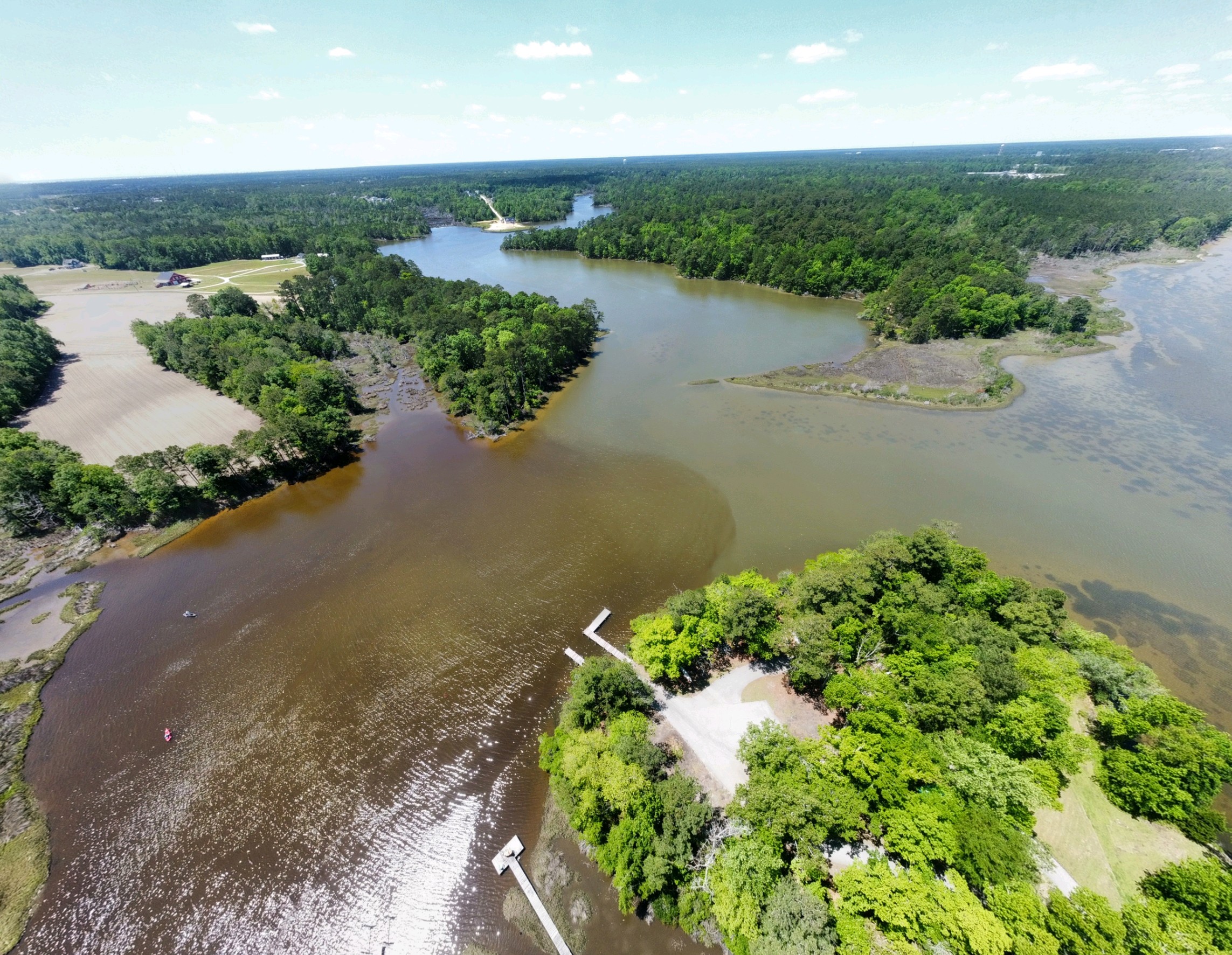
CCRW has reported (to NCDEQ DEMLR, Wilmington Regional Office) aerial photos taken by at CCRW volunteer near Stone’s Bay along the New River in Snead’s Ferry before and after rain during the week of April 13th, 2023. These photos show a visual representation of sediment release into the estuarine creeks that lead into the New River (Onslow County).
Click here to see photos documenting sediment runoff from the cleared land running into the adjacent creek and into Stones Bay (SOURCE: A.JONES 2023)
The impacted areas, of and adjacent-to the lower New River, include primary and special secondary nursery areas, estuarine shrub wetlands, bottomland hardwood wetlands, salt/brackish marsh wetlands, and is an area where there are both patchy and continuous areas of Submerged Aquatic Vegetation (SAVs). This is also the same area impacted by the 2022 Harmful Algae Bloom event.
Protecting these specific areas of our coastal habitat are highlighted in the 2021 CHPP Amendment, which is focused on priority solutions including “reducing sedimentation impacts in estuarine creeks”. Sedimentation, and the following degradation of water clarity, are a primary concern for SAV loss.